Runner-Up
Dr Rob Wiseman, Institute of Archaeology
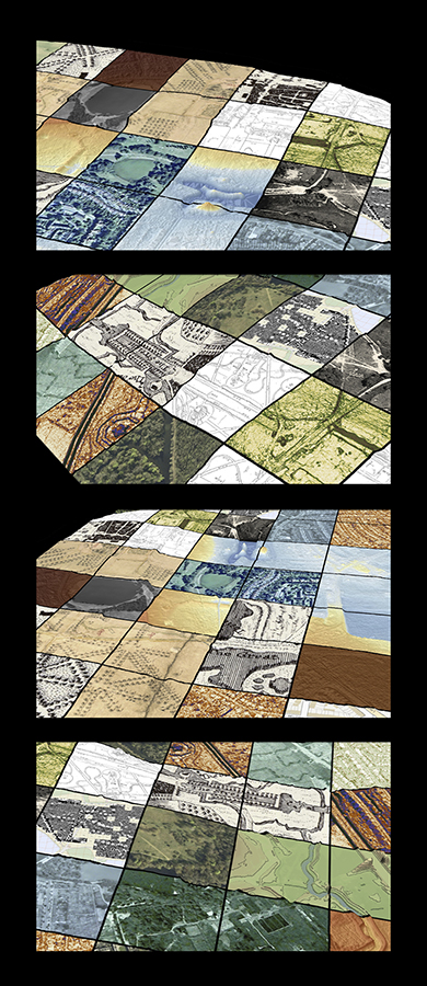
Wanstead Mosaic II
The British public's idea of archaeology lies somewhere between Indiana Jones and Time Team, with equal parts of trowels, trenches and treasure. But most archaeological projects start in the library and archive. Archaeology involves assembling a coherent picture from a mosaic of different sources – excavations, plans, aerial photographs, pictures, maps, geophysics, satellite images... At first glance, each might appear to have little to do with others, but patient examination reveals points of connection, and eventually a whole landscape emerges – first in two dimensions, then in three. Wanstead Park lies in east London and has a rich archaeological record. The mosaic is made up from eighteen images of the Wanstead area through time · historic maps (1745 and 1820) · Ordnance Survey getamap (©2011) c· magnetometry survey (2005-07) · aerial photographs (1944, 1966, 1967, 2004) · Google Earth (2006) · digital elevation models prepared from Environment Agency LiDAR data (2010, different images show elevation, relief, contour, slope, and curvature).
All images and text copyright their artist/author and MAY NOT be used for any purposes without the express permission of the original artist/author. All Rights Reserved, 2012.